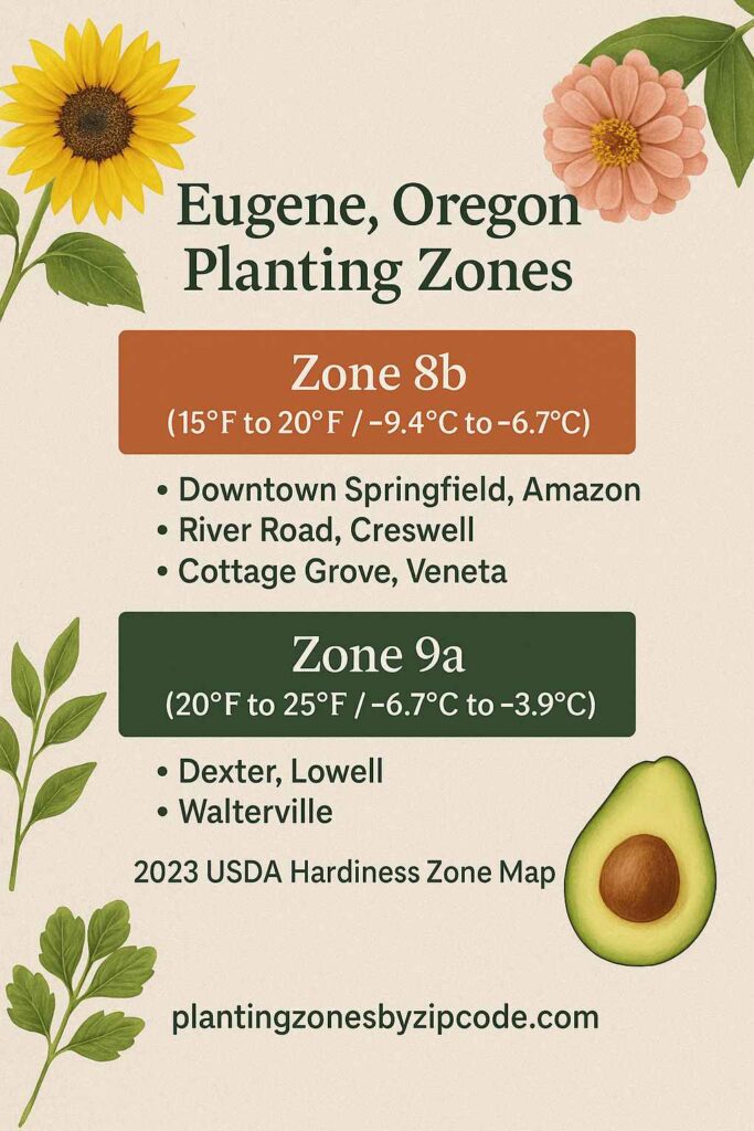
Eugene, Oregon falls under USDA Hardiness Zone 8b (15°F to 20°F / -9.4°C to -6.7°C), covering core urban areas like Downtown Springfield (97478), Amazon (97405), River Road (97404), as per 2023 USDA update.
Three neighborhoods, Dexter (97431), Lowell (97452), and Walterville (97489) experience localized Zone 9a conditions (-6.7°C to -3.9°C / 20°F to 25°F) due to microclimate variations.
Suburban regions such as Creswell (97426), Cottage Grove (97424), and Veneta (97487) also remain within Zone 8b, per the 2023 USDA data.
You can pinpoint your Eugene, Oregon, USDA zone using our three tools given below, Zipcode to planting zone tool, interactive map or by using planting zone table.
Eugene Planting Zones by ZipCode
Enter 5 digit Eugene Zipcode to find its USDA Planting zone.
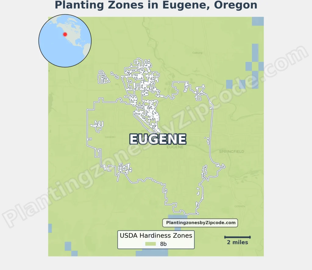
Eugene Planting Zones Map
Please Select or type your Eugene location in the selection box below to find its USDA Growing zone.
City Name
Eugene Area Planting Zone
Planting Zones
Planting Zones
Eugene Planting Zones Table
Following table lists all the locations in Eugene alogwith their USDA Hardiness zone.
| Eugene Location | Planting Zone |
|---|---|
| Loading Eugene zones data… | |
No items found matching your search
Try a different search term or clear the search field.
Download Eugene Planting Zone Map