
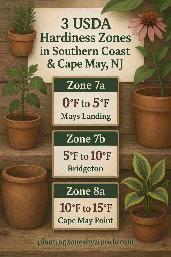
Southern Coast & Cape May, New Jersey has three different USDA Planting Zones 7a, 7b, and 8a, as declared by USDA update in 2023. Winter temperatures here range from 0°F to 15°F (-17.8°C to -9.4°C).
The coldest zone here is USDA zone 7a (0°F to 5°F / -17.8°C to -15.0°C) which covers areas like Mays Landing and parts of Atlantic County and Cape May County. The warmest zone is USDA zone 8a (10°F to 15°F / -12.2°C to -9.4°C) which includes Cape May Point and Wildwood Crest along the coastline.
Most coastal communities like Bridgeton, Cape May Court House, Mystic Island, Somers Point, Stone Harbor, and Swedesboro are in USDA zone 7b (5°F to 10°F / -15.0°C to -12.2°C) with winter lows of 5°F to 10°F.
Many areas here span multiple USDA zones like Atlantic City (7b-8a), Brigantine (7b-8a), Margate City (7b-8a), Ventnor City (7b-8a), and Williamstown (7a-7b).
To locate your USDA planting zone of NJ‘s Southern Coast & Cape May use our interactive map or the USDA hardiness zones table provided below.
Southern Coast & Cape May USDA Planting Zones Map
Select or type your Southern Coast & Cape May location in selection box below, to find its USDA Growing zone.
Select a location
USDA Planting Zone
This zone’s data comes from the United States Department of Agriculture (USDA), with the most recent zone updates released in 2023
Planting Zones
Planting Zones
Southern Coast & Cape May USDA Planting Zones Table
Southern Coast & Cape May, New Jersey has three USDA Planting Zones 7a, 7b, and 8a. The 16 USDA hardiness zone locations in Southern Coast & Cape May, New Jersey are Atlantic City, Atlantic County, Bridgeton, Brigantine, Cape May County, Cape May Court House, Cape May Point, Margate City, Mays Landing, Mystic Island, Somers Point, Stone Harbor, Swedesboro, Ventnor City, Wildwood Crest, and Williamstown. The 16 USDA hardiness zone locations in Southern Coast & Cape May, New Jersey are listed below.
| Location | USDA Hardiness Zone |
|---|
No items found matching your search
Try a different search term or clear the search field.