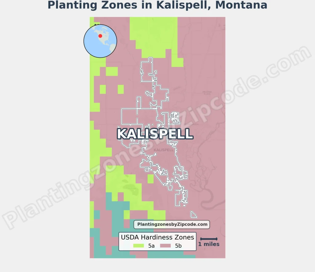
Kalispell, Montana lies in USDA Hardiness Zone 5b, experiencing average annual minimum temperatures of -15°F to -10°F (-26.1°C to -23.3°C) as per the 2023 USDA update. All major areas like Buffalo Hill, East Side Kalispell, Glacier Rail Park, Meadow Vista Loop, and Lone Pine State Park fall within this zone.
Neighboring areas range from Zone 5a (-20°F to -15°F / -28.9°C to -26.1°C) in Columbia Falls, Downtown Whitefish, and Whitefish Lake to Zone 6b (-5°F to 0°F / -20.6°C to -17.8°C) near Flathead Lake.
Find your Kalispell, Montana, USDA zone using our three tools given below, Zipcode to planting zone search tool, interactive map or by planting zone table.
Kalispell Planting Zones by ZipCode
Kalispell Planting Zones Map
Select or type your Kalispell location in the selection box below to find its planting zone.
Planting Zones
Planting Zones
Kalispell Planting Zones Table
| Kalispell Location | Planting Zone |
|---|---|
| Loading zones data… | |
Download Kalispell Planting Zone Map