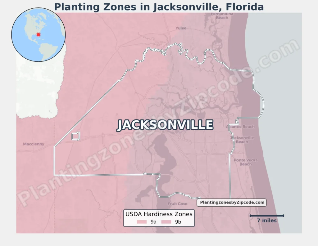
Jacksonville, Florida spans two Hardiness Zones, 9a and 9b, as per latest USDA map released in 2023.
Most areas fall within Zone 9b (25–30°F/-3.9°C to -1.1°C), including downtown (32202), beaches (32250), and southside neighborhoods (32256, 32246).
Western and northwestern sections like Macclenny and zip codes 32220, 32219, 32234, and 32099 belong to Zone 9a (20–25°F/-6.7°C to -3.9°C).
You can pinpoint your Jacksonville (Florida) USDA zone using our three tools given below, Zipcode to planting zone tool, location based interactive map or by searching planting zone table.
Jacksonville, Fl Planting Zones by ZipCode
Jacksonville, Fl Planting Zones Map
Select or type your Jacksonville location in the selection box below, to know its USDA Growing Zone.
City Name
Jacksonville Area Planting Zone
Planting Zones
Planting Zones
Jacksonville Planting Zones Table
| Jacksonville Location | Planting Zone |
|---|---|
| Loading Jacksonville zones data… | |
No items found matching your search
Try a different search term or clear the search field.
Download Jacksonville Growing Zone Map
Jacksonville, Florida primarily falls within USDA Hardiness Zone 9b and some parts of the city limits are situated in Zone 9a as clearly depicted in the planting zones map below.