
San Antonio, Texas, falls under two USDA planting zones (8b and 9a) as per USDA latest 2023 data. The subtropical climate determines San Antonio’s planting zones, with zone 8b occurring in northern areas like Stone Oak and zone 9a dominating 80% of the urban region.
Zone 8b features minimum annual temperatures of 15°F–20°F (-9.4°C to -6.7°C) in limited northern neighborhoods. Zone 9a spans most urban areas, including downtown and surrounding districts, with warmer minimums of 20°F–25°F (-6.7°C to -3.9°C).
You can find your San Antonio’s USDA zone using our three tools given below, Zipcode to planting zone tool, easy to use location based interactive map or by searching planting zone table.
San Antonio Planting Zones by ZipCode
San Antonio Planting Zones Map
Select or type your San Antonio’s location in the selection box below, to find its USDA Planting Zone.
City Name
San Antonio Area Planting Zone
Planting Zones
Planting Zones
San Antonio Planting Zones Table
| San Antonio Location | Planting Zone |
|---|---|
| Loading San Antonio zones data… | |
No items found matching your search
Try a different search term or clear the search field.
Planting zones in San Antonio, Texas
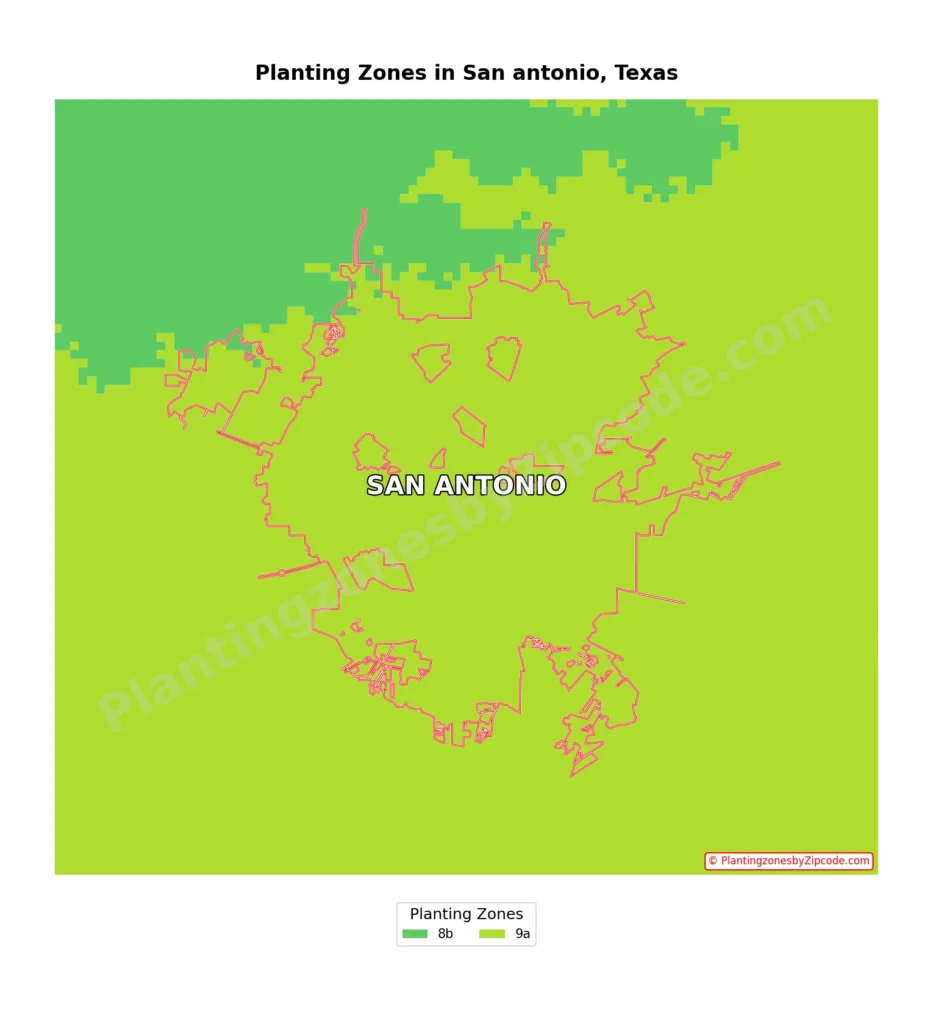
1. Zone 8b
Zone 8b is shown in darker green colored areas on our map above, primarily visible in the northern outskirts of San Antonio. While less prevalent in the San Antonio area, it’s important for gardeners in these regions to be aware of the slightly cooler conditions.
The zip codes areas 78255 and 78260 fall within this zone, indicating that areas like Stone Oak and parts of the Texas Hill Country north of the city proper experience these cooler temperatures.
2. Zone 9a
Zone 9a, shown by the lighter green color on our map, dominates the majority of the San Antonio area. This zone has average annual minimum temperatures ranging from 20°F to 25°F (-6.7°C to -3.9°C), making it slightly warmer than Zone 8b.
The vast majority of San Antonio’s zip codes fall within this zone, covering the heart of the city and its surrounding areas.