
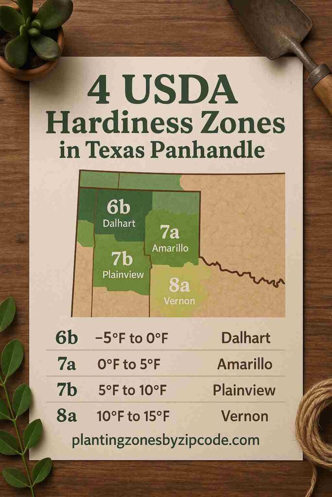
The Texas Panhandle from Amarillo to Childress covers four different USDA Planting Zones 6b, 7a, 7b, and 8a, as declared by USDA update in 2023. Winter temperatures here range from -5°F to 15°F (-20.6°C to -9.4°C).
The coldest zone in Texas Panhandle is USDA zone 6b (-5°F to 0°F / -20.6°C to -17.8°C) which covers parts of Dalhart. The warmest zone is USDA zone 8a (10°F to 15°F / -12.2°C to -9.4°C) here which includes Archer County and Vernon.
Most towns like Amarillo, Canyon, Dumas, Fritch, Happy, Muleshoe, Pampa, Panhandle, Perryton, Stinnett, and Wheeler are in the USDA zone 7a (0°F to 5°F / -17.8°C to -15°C) with winter lows of 0°F to 5°F.
Many areas here span multiple USDA zones like Childress (7b-8a), Dalhart (6b-7a), and Shamrock (7a-7b). Towns like Hedley, Plainview, and Quanah are all in USDA zone 7b (5°F to 10°F / -15°C to -12.2°C).
Locate USDA planting zone of your city or town of Texas Panhandle using the interactive map or the USDA hardiness zones table provided below.
USDA Zones Map of Texas Panhandle
Select or type your Texas Panhandle location in selection box below, to find its USDA Growing zone.
Select a location
USDA Planting Zone
This zone’s data comes from the United States Department of Agriculture (USDA), with the most recent zone updates released in 2023
Planting Zones
Planting Zones
Planting Zones Table of Texas Panhandle
Texas Panhandle region has four USDA Planting Zones from 6b to 8a. The 20 USDA hardiness zone locations in Texas Panhandle are Amarillo, Archer County, Canyon, Childress, Dalhart, Dumas, Fritch, Happy, Hedley, Muleshoe, Pampa, Panhandle, Perryton, Plainview, Quanah, Randall County, Shamrock, Stinnett, Vernon, and Wheeler. The 20 USDA hardiness zone locations in Texas Panhandle are listed below.
| Location | USDA Hardiness Zone |
|---|
No items found matching your search
Try a different search term or clear the search field.