
Houston, Texas has two USDA planting zones: 9a and 9b according to the 2023 USDA update. These zones reflect the city’s subtropical climate and Gulf Coast proximity. Zone 9a occupies Houston’s metropolitan outskirts with average annual minimum temperatures of 20°F to 25°F (-6.7°C to -3.9°C).
Zone 9b covers most urban and suburban Houston areas with temperatures from 25°F to 30°F (-3.9°C to -1.1°C), and includes most Houston zip codes. The 9a-9b transition results from Houston’s urban heat island effect and Gulf Coast influence.
You can pinpoint your Houston USDA zone using our three tools given below, Zipcode to planting zone tool, City location based interactive map or by using planting zone table.
Houston Planting Zones by ZipCode
Houston Planting Zones Map
Select or type your Houston location in the search box below, to find its USDA Planting Zone.
City Name
Houston Area Planting Zone
Planting Zones
Planting Zones
Houston Planting Zones Table
| Houston Location | Planting Zone |
|---|---|
| Loading Houston zones data… | |
No items found matching your search
Try a different search term or clear the search field.
2 planting zones in Houston, Texas
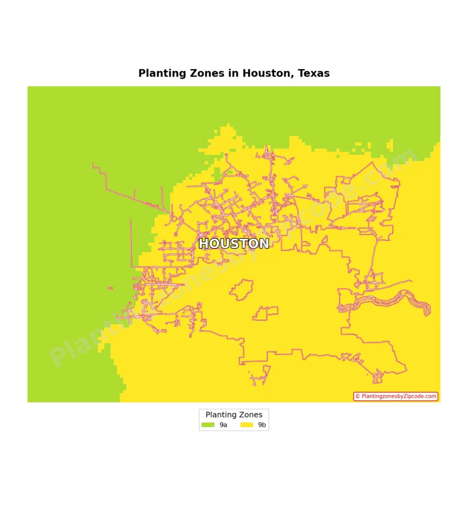
1. Zone 9a
This zone is shown in light green areas on our map above, which appear on the outskirts of the Houston metropolitan area. Zone 9a typically has average annual minimum temperatures ranging from 20°F to 25°F (-6.7°C to -3.9°C) and includes some of the more rural or suburban areas surrounding the city.
2. Zone 9b
Zone 9b, shown in yellow on the map, covers the majority of the Houston metropolitan area. This includes the entire urban core and most suburban areas of Houston (TX).
Key areas in Zone 9b of Houston include:
- Downtown Houston (zip codes 77002, 77010)
- The Texas Medical Center (77030)
- The Energy Corridor (77077, 77079)
- Clear Lake and NASA area (77058, 77059)
- The Galleria and Uptown (77056, 77057)
- Memorial and Spring Branch (77024, 77055)
- The Heights (77007, 77008)
- Bellaire (77401)