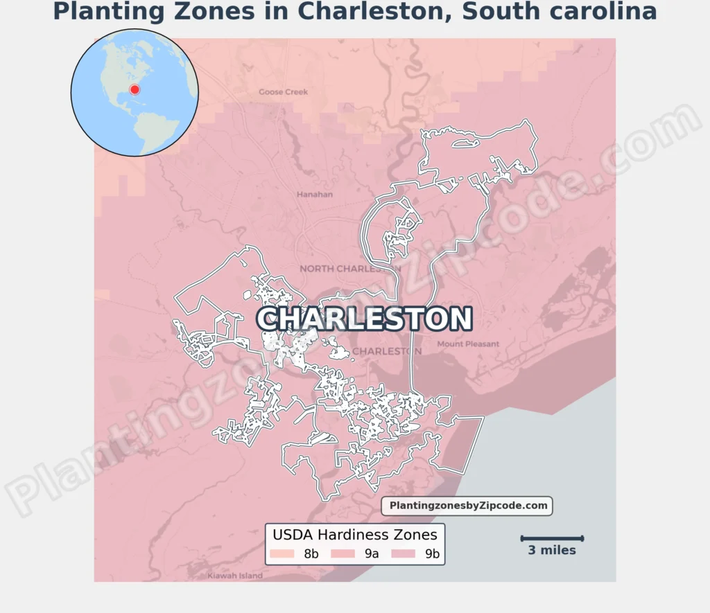
Charleston, South Carolina falls within USDA Hardiness Zone 9a, with average annual minimum temperatures of 20°F to 25°F (-6.7°C to -3.9°C) per the 2023 USDA classification. This zone covers all 16 Charleston zip codes, including downtown areas (29401, 29403), suburban Mount Pleasant (29464), coastal James Island (29412), and newer developments near Charleston International Airport (29492).
You can pinpoint your Charleston (South Carolina) USDA zone using our three tools given below, Zipcode to planting zone tool, Easy location based interactive map or by using planting zone table.
Charleston Planting Zones by ZipCode
Planting Zones Charleston Map
Select or type your Charleston location in the selection box below, to know its USDA Growing Zone.
City Name
Charleston Area Planting Zone
Planting Zones
Planting Zones
Charleston Planting Zones Table
| Charleston Location | Planting Zone |
|---|---|
| Loading Charleston zones data… | |
No items found matching your search
Try a different search term or clear the search field.
Download Charleston Planting Zones Map
As shown in the planting zone map below, zone 9a subtropical classification remains uniform across Charleston’s city geography. Gardeners can reliably grow zone 9a staples like satsuma oranges, windmill palms, and Confederate jasmine throughout the city’s peninsula and barrier islands.