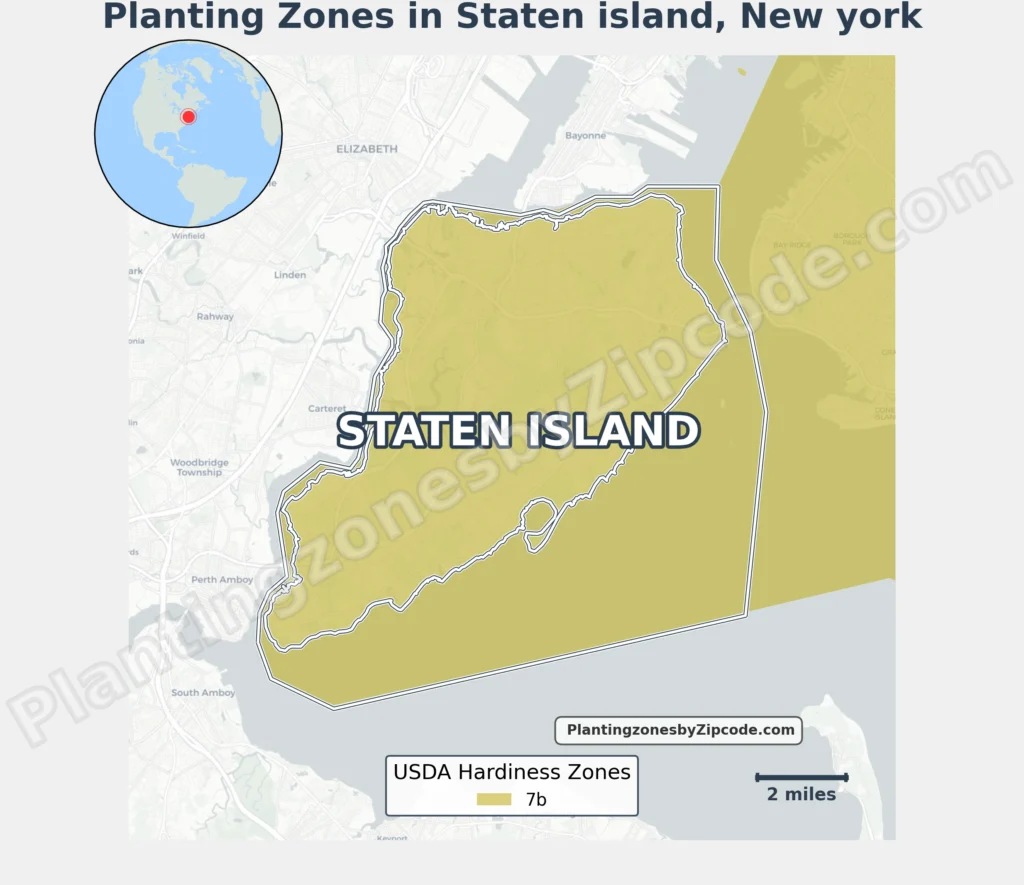
Staten Island, New York falls entirely within USDA Hardiness Zone 7b, featuring average annual minimum temperatures of 5°F to 10°F (-15°C to -12.2°C), according to the 2023 USDA update.
This classification covers all neighborhoods across the island including St. George, Tottenville, Great Kills, New Dorp, Annadale, and Eltingville, as well as areas like Todt Hill, Willowbrook, and South Beach.
To locate your Staten Island, New York, USDA zone use our three tools given below, zipcode to planting zone search tool, interactive map, or planting zone table.
Staten Island Planting Zones by ZipCode
Staten Island Planting Zones Map
Select or type your Staten Island location in the selection box below to find its planting zone.
City Name
Staten Island Area Planting Zone
USDA Planting Zone
—
USDA Planting zones help determine which plants are most likely to thrive in a location. This zone is based on the average annual minimum winter temperature. DATA SOURCE: USDA
Planting Zones
Planting Zones
Staten Island Planting Zones Table
| Staten Island Location | Planting Zone |
|---|---|
| Loading Staten Island zones data… | |
No items found matching your search
Try a different search term or clear the search field.
Download Staten Island Planting Zone Map