
New York City occupies USDA Hardiness Zone 7b according to the latest USDA data and mapped visualizations. The zone encompasses all five boroughs—Manhattan, Brooklyn, Queens, The Bronx, and Staten Island with identical temperature ranges of 5°F to 10°F (-15°C to -12.2°C) annually.
This uniformity supports urban gardening, landscaping, and park management by providing frost-date consistency across 483 square kilometers.
You can pinpoint your New York city USDA zone using our three tools given below, Zipcode to planting zone tool, location based interactive map or by using planting zone table.
New York City Planting Zones by ZipCode
New York city Planting zone Map
Select or type your New York city location in the selection box below, to know its USDA Planting Zone.
City Name
New York City Area Planting Zone
Planting Zones
Planting Zones
New York city Planting Zones Table
| New York City Location | Planting Zone |
|---|---|
| Loading New York City zones data… | |
No items found matching your search
Try a different search term or clear the search field.
Planting zone in New York City
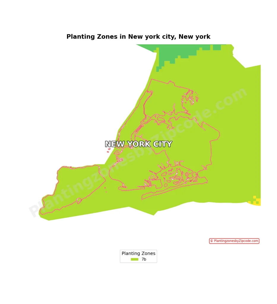
Zone 7b
New York City’s USDA Hardiness Zone is 7b, as shown by the light green color covering the entire city area on our map above.
Some of the areas within this zone include Central Park in Manhattan (ZIP code 10024), Downtown Brooklyn (ZIP code 11201), Flushing in Queens (ZIP code 11354), Riverdale in The Bronx (ZIP code 10471), and St. George in Staten Island (ZIP code 10301). All of these locations, along with every other neighborhood in New York City, share the same 7b planting zone characteristics.
Please note that while the entire city falls within Zone 7b, microclimates can still exist due to factors such as building density, proximity to some water bodies, and variations in elevation. These local variations may slightly affect growing conditions in your specific areas, but the main planting zone remains consistent across New York City.