
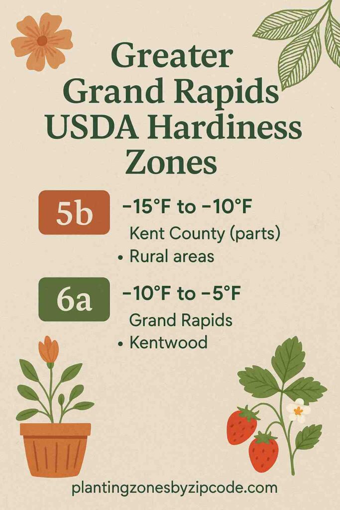
Greater Grand Rapids from Grand Rapids to Kentwood has two different USDA Planting Zones 5b and 6a, as declared by USDA latest update of 2023. Annual average minimum winter temperatures here range from -15°F to -5°F (-26.1°C to -20.6°C).
Greater Grand Rapids coldest zone is USDA zone 5b (-15°F to -10°F / -26.1°C to -23.3°C) which covers parts of Kent County. The warmest zone is USDA zone 6a (-10°F to -5°F / -23.3°C to -20.6°C) which includes most cities in the region.
Most towns like Grand Rapids, Kentwood, Wyoming, Grandville, Hudsonville, and Jenison are in the USDA zone 6a with winter lows of -10°F to -5°F.
Kent County spans two USDA zones (5b-6a). Smaller towns like Allendale, Byron Center, and Caledonia are all in USDA zone 6a. Locate your USDA growing zone using interactive map or hardniess zones table given below.
USDA Zones Map of Greater Grand Rapids
Select or type your Greater Grand Rapids, Michigan, location in selection box below, to find its USDA Growing zone.
Select a location
USDA Planting Zone
This zone’s data comes from the United States Department of Agriculture (USDA), with the most recent zone updates released in 2023
Planting Zones
Planting Zones
Planting Zones Table of Greater Grand Rapids
Greater Grand Rapids region has two USDA Planting Zones 5b and 6a. The 10 USDA hardiness zone locations in Greater Grand Rapids are Allendale, Byron Center, Caledonia, Grand Rapids, Grandville, Hudsonville, Jenison, Kent County, Kentwood, and Wyoming. The 10 USDA hardiness zone locations in Greater Grand Rapids are listed below.
| Location | USDA Hardiness Zone |
|---|
No items found matching your search
Try a different search term or clear the search field.