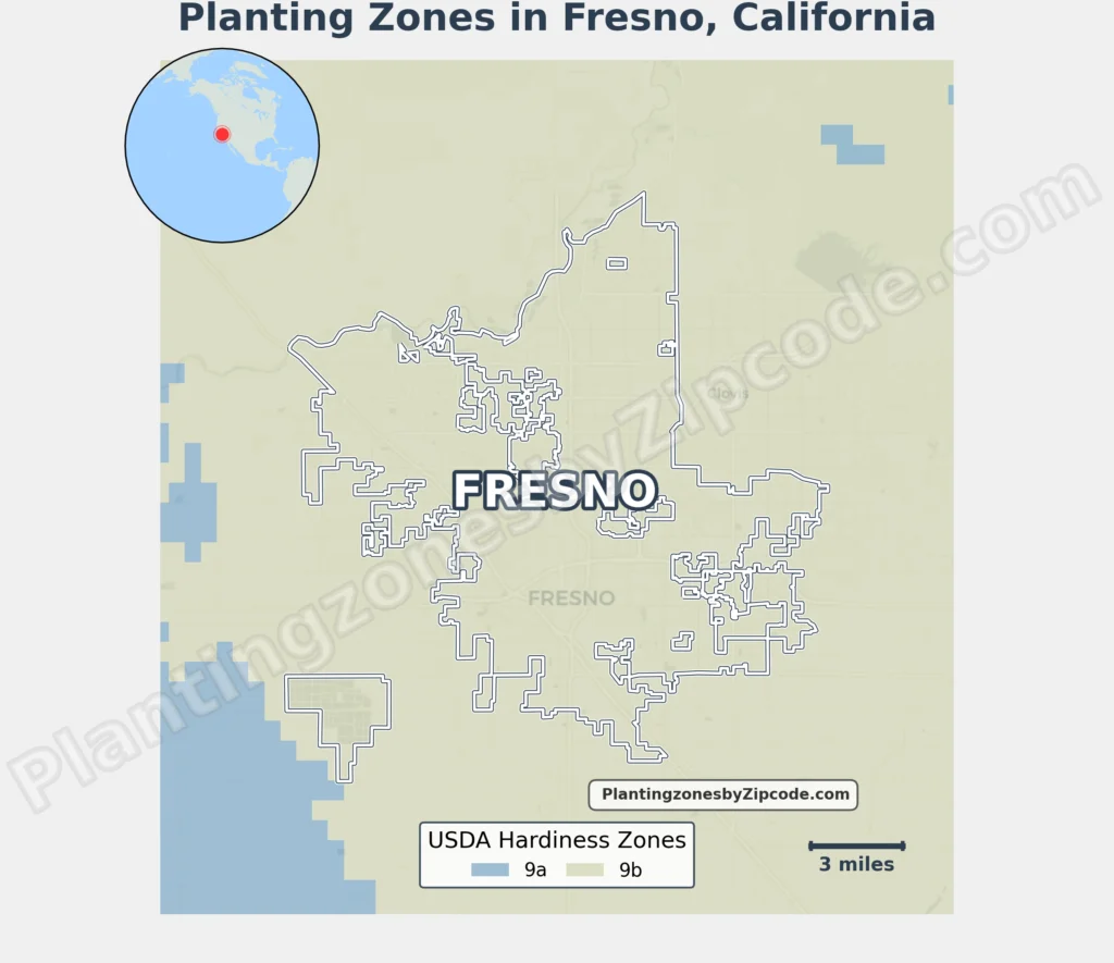
Fresno, California’s USDA Hardiness Zone is 9b, with average annual minimum temperatures of 25°F to 30°F (-3.9°C to -1.1°C).
This zone covers areas in downtown and suburban like Woodward Park, Tower District, and Fig Garden. All Fresno neighborhoods, such as North Fresno, Bullard, and Sunnyside, align with Zone 9b.
To verify your Fresno, California, USDA zone use our three tools given below, zipcode to planting zone search tool, interactive map, or planting zone table.
Fresno Planting Zones by ZipCode
Fresno Planting Zones Map
Select or type your Fresno location in the selection box below to find its planting zone.
City Name
Fresno Area Planting Zone
USDA Planting Zone
—
USDA Planting zones help determine which plants are most likely to thrive in a location. This zone is based on the average annual minimum winter temperature. DATA SOURCE: USDA
Planting Zones
Planting Zones
Fresno Planting Zones Table
| Fresno Location | Planting Zone |
|---|---|
| Loading Fresno zones data… | |
No items found matching your search
Try a different search term or clear the search field.
Download Fresno Planting Zone Map