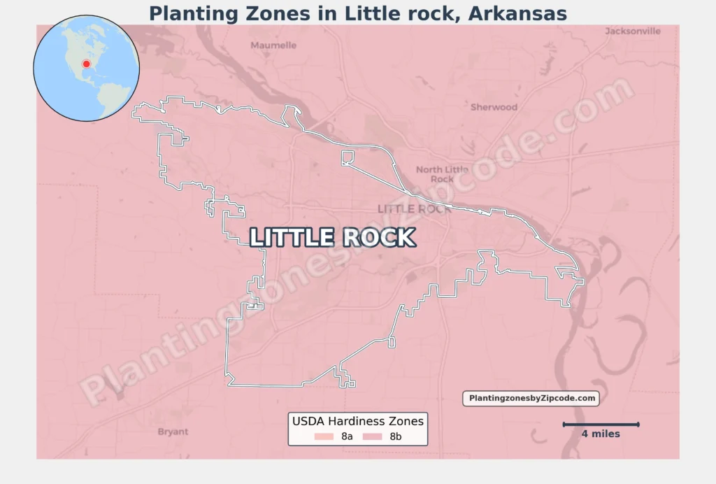
Little Rock, Arkansas falls entirely within USDA Hardiness Zone 8a, having average annual minimum temperatures of 10°F to 15°F (-12.2°C to -9.4°C), according to the latest USDA, 2023, classification.
This zone spans all zip codes across the city, including central areas like downtown’s 72201 and 72202, midtown neighborhoods such as 72205 and 72207, and suburban regions like 72227 near the Chenal Valley.
You can pinpoint your Little Rock (Arkansas) USDA zone using our three tools given below, Zipcode to planting zone tool, Easy interactive map or by using planting zone table.
Little Rock Planting Zones by ZipCode
Planting Zones Little Rock Map
Select or type your Little Rock location in the selection box below, to know its USDA Growing Zone.
City Name
Little Rock Area Planting Zone
Planting Zones
Planting Zones
Little Rock Planting Zones Table
| Little Rock Location | Planting Zone |
|---|---|
| Loading Little Rock zones data… | |
No items found matching your search
Try a different search term or clear the search field.
Download Little Rock Planting Zones Map
The uniformity of Zone 8a across Little Rock’s metro area—from the Arkansas River-adjacent 72204 to the western outskirts of 72212 and 72223—ensures predictable growing conditions citywide. This stability enabling gardeners in urban apartments (72203) or leafy subdivisions (72211) to reliably grow cold-tolerant perennials such as camellias and figs.