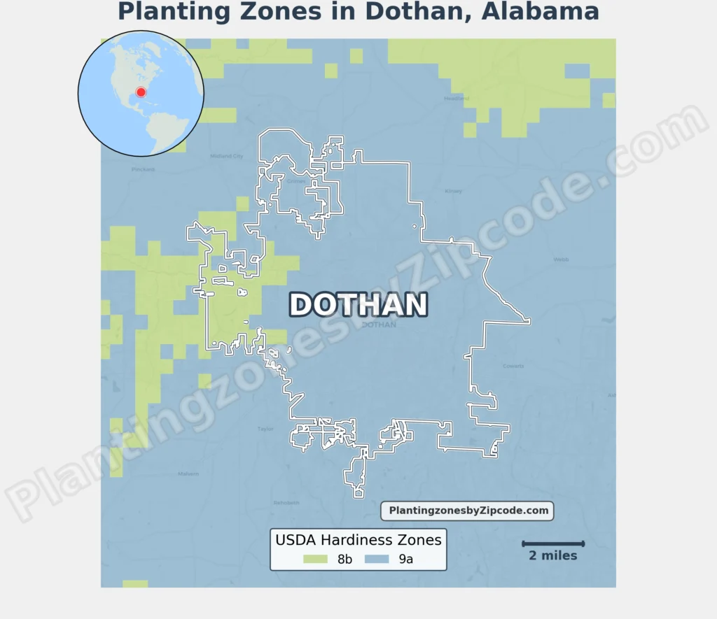
Dothan, Alabama spans two USDA Hardiness Zones: 8b and 9a. The city primarily lies in Zone 9a (20°F to 25°F/-6.7°C to -3.9°C), covering neighborhoods including Downtown Dothan, East Dothan, Forest Park, and Meadowbrook.
A western section of Dothan falls into Zone 8b (15°F to 20°F/-9.4°C to -6.7°C), covering Brannon Stand Heights, Brentwood West, Green Acres, Highlands, Newton, and Quail Creek.
To verify your Dothan, Alabama, USDA zone use our three tools given below, zipcode to planting zone search tool, interactive map, or planting zone table.
Dothan Planting Zones by ZipCode
Dothan Planting Zones Map
Select or type your Dothan location in the selection box below to find its planting zone.
Planting Zones
Planting Zones
Dothan Planting Zones Table
| Dothan Location | Planting Zone |
|---|---|
| Loading zones data… | |
Download Dothan Planting Zone Map